
280 Miles Across the Mojave Desert | What Could Go Wrong?
- Jens Brown

- Mar 25
- 5 min read
Updated: Mar 25
Across the Mojave: Parker Dam to Nelson, Nevada
We started this trip at Parker Dam on the Colorado River with a plan to spend a few days working north across the Mojave Desert toward Nelson, Nevada. The route covered roughly 280 miles, linking together mining roads, desert tracks, and sections of historic corridor along the river. On paper, it looked straightforward. Once we got into the trail, it started to change.
🎥 Watch the full trip video
Parker Dam to Dynamite Canyon
We rolled out from Parker Dam early, leaving the Colorado River behind and moving into open desert. The terrain transitions quickly here. Water gives way to dry washes and volcanic ground, with long stretches of empty space between features.
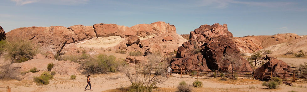
Dynamite Canyon comes up early and sets the tone for the trip. The canyon cuts through dark volcanic rock, mostly fractured basalt and loose stone that keeps speeds down and requires steady line choice. The name traces back to early mining activity, when small crews used blasting powder to open cuts through the rock while chasing mineral seams.

There is not much left in terms of structures, but the terrain tells the story. Broken rock, narrow passages, and disturbed ground hint at the kind of work that once happened here. It is a place that slows you down and makes you pay attention to the ground more than the map.
Whipple Wash and Whipple Cave
From there, the route drops into Whipple Wash, a wide sandy drainage that shifts depending on recent weather. Tracks fade in places, and the trail becomes less defined. You spend more time reading the terrain than following a clear path.
Whipple Cave sits off this section, tied to the same pattern of exploration that runs through the Mojave. It is less a natural cave and more likely the result of prospecting, where miners followed veins into the hillside.

There are no signs or markers. Just an opening in the rock and the surrounding desert. Like most of these sites, it is easy to pass without noticing unless you know where to look.
West Well and Heritage Trail
West Well marks one of the more recognizable stops along this stretch. Historically it served as a water point along early desert crossings, including segments tied to the Mojave Road. Even now, it stands out simply because water, or the memory of it, shaped movement through this region.
From there, the Heritage Trail connects older travel routes. These are not engineered roads. They are paths built over time by Native travel, military movement, and later mining access.
Driving it now, you are following lines that were established long before vehicles.
Mojave Preserve and Leiser Ray Mine
As the route pushes deeper into the Mojave National Preserve, the terrain opens up again. Broad valleys, distant ridgelines, and fewer signs of recent travel.
Leiser Ray Mine stands out in this section.

Unlike smaller prospect sites, this one shows a more developed footprint. Tailings, structural remnants, and scattered equipment mark the hillside, giving a clearer sense of scale. The mine dates back to the early 1900s, when gold exploration expanded across this region.

Walking through it, you can trace how material moved through the site. Extraction points, processing areas, and the remains of infrastructure are still visible if you take the time to look. It is not preserved or interpreted. What is left is exposed to the elements, slowly breaking down, but still readable.
Fort Piute and the Mojave Road
Further north, Fort Piute anchors the route in an earlier period. Established in 1859, the fort was built to protect travel along the Mojave Road, a critical corridor connecting the Colorado River to Southern California. What remains today is minimal, but the location still makes sense when you stand there. Water, visibility, and position along the route all come together.

From here, the Mojave Road becomes more defined. Sections of Old Government Road carry that same alignment,http://centuries.It continuing one of the earliest routes across this desert.
Lake Mohave and Grapevine Canyon
As the route bends toward Lake Mohave, the landscape shifts again. The presence of water changes the feel of everything around it. Grapevine Canyon sits just beyond, and it is one of the more significant cultural sites along the trip. The petroglyph panels cover large sections of rock, with figures and symbols carved over centuries. It is a reminder that this landscape has been traveled for a very long time, long before mining or modern routes.

Christmas Tree Pass and Empire Wash
Climbing out from the river corridor, Christmas Tree Pass offers a gradual ascent with wider views back across the desert. The terrain opens and the road becomes less confined.
Empire Wash and the surrounding mine sites bring the focus back to smaller operations. Scattered remains of mining activity follow the same pattern seen across the Mojave. Discovery, a period of work, and then abandonment.
Dropping back toward the water near Nine Mile Cove, we slowed down and took time near the shoreline. It is one of the better places along the route to stop and reset. Not long after, the trip shifted. A mechanical issue with one of the Jeeps turned into something more serious. What started as troubleshooting became a series of decisions about how to keep moving and what needed to be fixed.

The issue traced back to the battery system and escalated quickly enough that we had to leave the route. A run out to Bullhead City became part of the trip. Finding parts, making repairs, and getting everything back into working order took time, but it was necessary to continue. Back on the trail, adjustments continued. Managing heat, improvising where needed, and keeping things stable in desert conditions.
Powerline Roads and Oro Plata Mine
The return to dirt brought us onto powerline roads and more exposed terrain.
The run through this section and out toward Oro Plata Mine added a different kind of driving. Faster stretches mixed with abrupt climbs and descents. The rollercoaster sections live up to the name, requiring attention to momentum and control more than technical crawling.
Final Descent Toward Nelson
The final stretch included a steep descent in places, requiring careful line choice and steady braking. By this point, the trip had shifted from its original plan. The focus was on finishing clean and getting everything out intact.
Nelson marked the end of the route, with its more concentrated mining remains and easier access back to pavement. This route is not defined by a single obstacle or landmark.
It is defined by progression. From river to canyon, from mining roads to historic routes, from plan to adjustment.

From Parker Dam to Nelson, the Mojave does not give you a fixed experience. It changes as you move through it, and the trip becomes something different than what you expected.
That is part of the reason to run it.
Trail Guide

Hardline readers looking for detailed GPS tracks, current conditions, and obstacle walkthroughs can check out the official TrailsOffroad write-up for this route.
Use TrailsOffroad with our 'Discount Code' to save on a TrailsOffroad membership and unlock thousands of trail guides across the Southwest and beyond.
👉 TrailsOffroad - Mojave Road
👉 TrailsOffroad - Telephone Cove Road
👉 TrailsOffroad - Christmas Tree Pass
👉 TrailsOffroad - Combination Mine Road
👉 TrailsOffroad - Nelson Roller Coaster


Comments