
Utah BDR Segment 1: From Phoenix to Blanding — Valley of the Gods, Moki Dugway & The Emigrant Trail
- Jens Brown

- Oct 8, 2025
- 7 min read
Updated: Dec 2, 2025
Leaving Home
Every trip begins before the first mile. The night before departure, the gear’s laid out, the maps checked twice, the cooler half-packed but waiting for ice. Then, morning comes early — headlights on asphalt and the hum of a loaded rig rolling north from Phoenix, chasing the kind of distance that changes your sense of scale.
The road to Flagstaff climbs more than 5,000 feet, cutting from the low Sonoran Desert through juniper flats into ponderosa pine forest. By midafternoon, the temperature drops thirty degrees and the air smells clean, sharp with resin.
This is where I meet up with the Offroad Overland Camping crew — friends and fellow travelers who share the same appetite for dust, open country, and quiet places. The rigs — a mix of Jeeps, a Grenadier and a Rivian — line up beneath the pines, radios checked, cameras mounted, and gear strapped down.

There’s a rhythm to the night before a trip: laughter, gear talk, the faint nervous energy that comes before the first dirt road. We’re heading north at sunrise — toward red rock, open mesas, and one of the most scenic and historically layered off-road routes in the West: the Utah Backcountry Discovery Route.
Crossing the Navajo Nation
Leaving Flagstaff at dawn, Highway 89 rolls out across the Navajo Nation, a sovereign land that covers more than 27,000 square miles of Arizona, Utah, and New Mexico. It’s not empty - it’s vast, living, and deeply rooted.
Scattered homes and sheep corrals dot the landscape. Trading posts stand as reminders of older economies — places where wool, silverwork, and stories were traded long before there were state lines. The land is open but intimate; everything here feels connected to the horizon.
The Navajo people call themselves Diné, meaning “the people.” Their connection to this land runs deeper than the road, deeper than the trails we follow. To drive through this country is to cross a landscape that has carried stories for centuries - of migration, survival, and resilience.
The Monument Valley skyline rises slowly from the desert floor, its towers glowing in the morning light. Even from miles away, the scale is disorienting — each butte and spire standing like an ancient monument. The land itself feels sacred, not just scenic.

We stop briefly near Forrest Gump Point, the iconic stretch of highway made famous by film
but known far longer by the Diné as Tsé Biiʼ Ndzisgaii — the Valley of the Rocks. It’s one of those places where the camera never quite captures the feeling. The silence, the space, the deep reds and shadows — it all humbles you.
Monument Valley sits within the Navajo Nation and is managed by the tribe. Driving its backroads requires a local permit, and rightly so — this is not just land, it’s home. The Utah BDR skirts the western edge of this territory, respecting that boundary before turning north into Valley of the Gods — a landscape often described as Monument Valley’s smaller sibling, but no less profound.

Valley of the Gods
By late morning, the road transitions from pavement to packed dirt. The trail through Valley of the Gods stretches for seventeen miles, weaving between buttes, spires, and mesas sculpted from Cedar Mesa sandstone. After last night’s rain, the surface is firm and nearly dustless — a rare gift in red rock country.
The formations have names that sound both playful and reverent: Lady in the Bathtub, Rooster Butte, Battleship Rock. The locals named them generations ago, seeing shapes in the stone the same way we see faces in clouds.
We set camp beneath the Seven Sailors, a line of sandstone towers that rise like sentinels from the valley floor. As evening falls, the light softens to amber, the air cooling fast under an open sky. Out here, the silence is a sound all its own — broken only by the occasional wind brushing through creosote.

Night brings stars in impossible numbers. No city glow, no hum of highways — just the pulse of desert quiet and the sense that the landscape itself is still breathing from the heat of the day.
Climbing the Moki Dugway
Morning breaks clear and cold. Coffee on the stove, tents collapsing in slow rhythm, cameras catching the first light hitting the sandstone walls.
We roll out toward Moki Dugway, a name that feels casual until you see the road. Carved in the 1950s by the Texas Zinc Minerals Company, it climbs three miles up the face of Cedar Mesa, rising 1,200 feet through a series of narrow, gravel switchbacks. It was built to haul uranium ore - and still feels like it.
The climb is steady but exposed. No guardrails, just a thin strip of road cut into sheer cliffs. The view expands with every turn - Valley of the Gods shrinking below, Monument Valley stretching into the haze beyond, and the San Juan River winding through canyons like a silver thread.
From the top, you can see nearly a hundred miles - across three states and what feels like three geologic eras. It’s not a technical climb, but it’s one that commands respect. You drive it slowly, and you remember it long after the engine cools.
The Emigrant Trail & The Hole-in-the-Rock Route
From the top of Cedar Mesa, the trail runs north across open country that feels untouched. This section of the Utah BDR follows the Emigrant Trail, also known as the Snow Flat Road, part of the historic Hole-in-the-Rock Expedition route of 1880.
The Hole-in-the-Rock pioneers were Mormon settlers sent to establish a new community on the banks of the San Juan River, what would become the town of Bluff. They carved and blasted their way through 200 miles of canyon country - some of the harshest terrain in the Southwest.
When they reached Cedar Mesa, the land broke apart in front of them in a labyrinth of canyons, cliffs, and mesas. Scouts eventually found a way through, cutting a path that’s still visible in places today. That same route, in part, is what we follow now.

Driving it today feels effortless — traction control, suspension, air conditioning. But when you know the history, every rock and rut feels like a monument to their endurance. The road winds through slickrock and sage, crossing shallow mud holes left by the last storm. The Twist, a section of rough, undulating slickrock, demands attention even with modern gear.
To the east, Comb Ridge cuts the horizon like a giant spine. To the north, the twin buttes of Bears Ears rise above the mesa — landmarks not just for navigation, but for spirit. For the Diné, Ute, and Hopi, this land holds stories older than any map.
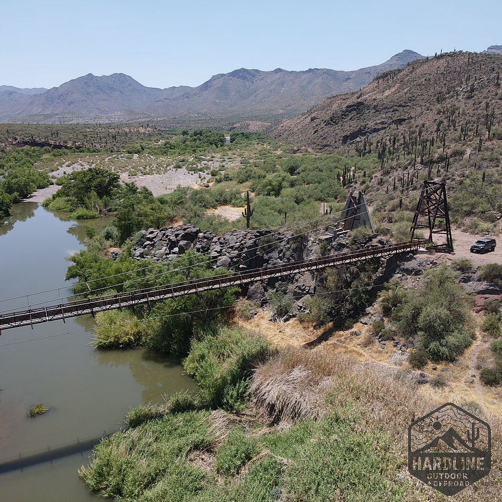
Butler Wash and the Wolfman Petroglyphs
By midday, the trail drops off Cedar Mesa into Butler Wash, a long valley running parallel to Comb Ridge. The terrain softens again — cottonwood trees, sandy stretches, and hidden alcoves where time seems to gather.
We pull off for lunch and hike down to the Wolfman Petroglyph Panel, a steep descent into an alcove carved by water and time. The figures etched into the rock are striking — human forms with elongated arms, animals, geometric shapes, and the distinctive “wolfman” himself.

No one knows the precise meanings, but standing there, the silence feels different. These
carvings were messages — memories in stone — left by the Ancestral Puebloans nearly a thousand years ago. They farmed these canyons, built dwellings in the cliffs, and left a record of their world that still speaks across time.
After the hike, we continue north up the wash. The track is narrow, winding between low ridges and small dry crossings. It’s an easy drive, but the scenery makes you slow down anyway. The day ends at the Butler Wash Ruins, where ancient dwellings cling to the rock face beneath a massive sandstone overhang — the past, literally built into the land.

Climbing Into Elk Mountain
We leave Blanding late in the day, refueled and road-dusted, heading east toward the high country. The terrain begins to climb almost immediately — the red rock fading behind us, the color of the land shifting toward green.
The route winds through pinyon and juniper, then into stands of ponderosa pine. With every mile, the air cools, the shadows lengthen, and the smell of the forest replaces the scent of desert dust.
By dusk, we reach Elk Mountain, tucked within the Manti–La Sal National Forest. The rigs roll into camp one by one, headlights filtering through the trees. The sound of gravel gives way to stillness, broken only by the wind moving through aspen leaves.

It feels like a different world — cooler, quieter, alive in a different way. The desert heat is a memory now. As the campfire takes, we look back on two days that carried us across more than landscapes — from civilization into silence, from sandstone towers to mountain air.
Tomorrow, we’ll head north again, deeper into Utah’s backcountry. But for now, the forest is enough.
Read & Watch the Full UtahTrip
This post is part of Hardline HQ’s multi-day journey across the Utah Backcountry Discovery Route — from the mesas of Monument Valley to the alpine passes of the La Sals and Book Cliffs. Each article captures the story behind the drive, but the full experience lives on video.👉 Watch the entire Utah BDR series on YouTube: Hardline HQ Channel


Comments