
Alpine Utah Overland
- Jens Brown

- Nov 23, 2025
- 5 min read
Updated: Dec 2, 2025
The Final Miles of the Utah BDR - Soapstone Basin to Evanston, Wyoming
The Utah Backcountry Discovery Route reached its conclusion on Day Eight. The previous days took us through different landscapes which included canyon edges and desert plateaus and isolated rock formations and extensive forest paths. Our last day started peacefully at Soapstone Basin where we set up camp near the South Fork of the Provo River. The mountain air remained motionless while the temperature stayed at a frigid level which indicated autumn was transitioning into winter.
The group decided to stop at Evanston Wyoming as their final destination. The northern section of the BDR which leads to Idaho will be explored at a future time.
Watch the Video: https://youtu.be/YHnUB_MQFtI
Glacial Boulders - Upper Provo
The route followed Forest Road 037 as we ascended through lodgepole pine forests which surrounded the Provo River drainage system. The western side of the forest displayed Pitt Hill and Page Hill and Haystack Mountain which served as unobtrusive landmarks in the mountains that had experienced centuries of seasonal migration. The Ute people used to traverse these river valleys while following wildlife and natural seasonal patterns before European surveyors first arrived in the early 1900s.
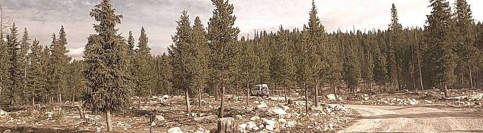
The higher elevation of the slope started to expose the ancient history of the Uintas mountain range. The Uinta Mountain Group quartzite formation in this mountain range extends from east to west because it originated from ancient seafloor sediment which became rock after 700 million years of transformation. The last Ice Age created alpine glaciers which occupied these high mountain basins while they sculpted cirque walls and moved boulders down slopes and produced the scattered moraines that we encountered on the road. The current meadow stones which stem from glacial ice movement during the last ice age remain in their original positions from that time period.
The ascent from Soapstone Base led us through a forested area before we entered the glacially shaped basins which lay ahead along the Mirror Lake Highway.
Pass Lake, Mirror Lake, and the Edge of Winter
The dirt road ended after ten miles when we reached SR-150 which became the Mirror Lake Highway. The road ascended through numerous bends between sparse tree coverage while the temperature dropped and the scenery revealed the high Uinta Mountains.
We made a stop at Pass Lake which reached an elevation of 10,500 feet while located near Bald Mountain. The trees reached their highest point just above our position while the lake shoreline displayed its last autumn colors. The alpine season operates with limited duration in this mountainous region. The first snowfall of October brings unexpected weather while the winter season brings deep snow accumulation that reaches between 15 to 20 feet in these mountain basins.

The two lakes of Pass Lake and Mirror Lake exist within glacial basins which feature steep walls and flat rock surfaces and deep water storage areas. The lakes remained accessible during early fall but the evening temperatures indicated that their surfaces would start freezing from the edges.
The Civilian Conservation Corps built most of the highway that brought us to this point during the 1930s. The stone culverts and roadbeds and drainage systems built by the CCC continue to function as vital infrastructure.
North Toward Whitney Reserve
Beyond Bald Mountain the highway kept to its high perch, crossing a mix of open meadows, wet ground, and pockets of spruce. Snowmelt ran in thin threads across the flats, feeding patches of grass that somehow stay green longer than you’d expect at this elevation. It’s the kind of country where movement has always followed the seasons - Indigenous hunters once used these passes, and later sheepherders brought their flocks through the Uintas along nearly the same paths.

At Whitney Reserve we dropped off the pavement and returned to dirt. The road wandered quietly, never in a hurry, weaving between timber, open benches, and a few shallow creeks. Nothing dramatic - just the kind of steady, satisfying backcountry track that settles you into the day.

Chalk Creek Valley and the Antelope Herd
Chalk Creek Road eventually opened into a wide valley backed by rolling hills. Near the creek bottom, a small herd of antelope was grazing in the mid-morning light. For a moment, the whole scene felt strangely like a western version of a safari: broad country, slow movement, and the animals doing their own thing on the slope.

One antelope finally lifted its head and then another. In the next heartbeat the entire herd spun and sprinted across the flats - gone in a flash.
People have moved through this valley for generations: Ute families, early trappers, and ranchers who began settling here in the 1860s. Their presence is still visible in the fencelines and the way the land is shaped and used today.
Crossing Into Wyoming and Entering Evanston
A little farther on, Utah simply gave way to Wyoming with no sign or marker—just a subtle shift in the land’s contours. The road carried us through open ranch country and past the Kern River gas facility, part of a large pipeline network running across the West.
From there, Yellow Creek Road angled north toward Evanston. Scattered houses appeared first, then the more orderly grid of town. Evanston grew in the 1870s as a critical service point for the Union Pacific Railroad.

Steam locomotives once stopped here for coal, water, and mechanical work, and the rail yard became one of the busiest stretches between Omaha and Sacramento. The old roundhouse and machine shops - heavy masonry structures built to shrug off long winters - still stand at the edge of town.

Chinese laborers played a significant role in constructing and maintaining this section of the
line, particularly during its early decades when winter storms routinely halted operations. Though rail activity has thinned over time, the historical structure remains woven into the town’s layout and architecture.
Reaching Evanston after a week on the BDR felt like a fitting conclusion; ancient geology, alpine corridors, and quiet forest roads giving way to a historic railroad town that once connected the West.
Trip Details
Route:Soapstone Basin → FR037 → FR150 → Mirror Lake Highway (SR-150) → Bald Mountain Pass → Pass Lake → Whitney Reserve → Chalk Creek Road → Yellow Creek Road → Evanston, Wyoming
Distance: ~100 miles
Terrain:Forest roads, high-altitude pavement, alpine meadows, glacial basins, rolling valleys, open ranch land
Elevation:7,800 ft at Soapstone Basin → 10,500 ft at Bald Mountain Pass → 6,800 ft at Evanston
Highlights:Mirror Lake Highway, Bald Mountain Pass, Pass Lake, glacial basins, fall color at elevation, Chalk Creek Valley, antelope herd, Evanston’s historic railroad structures
Seasonal Notes:Cold mornings; sudden weather shifts; early snowfall likely at 10,000+ ft; lakes begin freezing in October. Mirror Lake Highway closed in Winter, much of these roads are likely impassable in Winter.
Caution:Rapid temperature swings at elevation; wildlife along Chalk Creek Road; limited services between Soapstone Basin and Evanston
Camping:Soapstone Basin (previous night); limited dispersed options near Mirror Lake; additional sites south of Whitney Reserve
Read & Watch the Full UtahTrip
This post is part of Hardline HQ’s multi-day journey across the Utah Backcountry Discovery Route — from the mesas of Monument Valley to the alpine passes of the La Sals and Book Cliffs. Each article captures the story behind the drive, but the full experience lives on video.👉 Watch the entire Utah BDR series on YouTube: Hardline HQ Channel


Comments